Using geographic information systems (GIS) to view and shape the world around us
November 16, 2021
November 16, 2021
GIS Day focuses on professionals sharing their passion and examples of real-world applications of GIS that are making a difference in society
We asked Dominika Sawicka, senior GIS analyst in our water business, about her career, the future of GIS and how it can shape our world around us for the better.
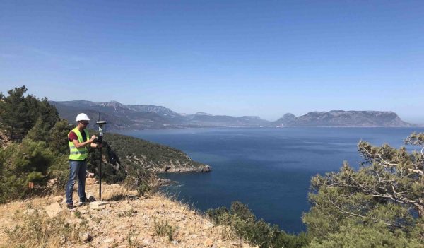
I studied Environmental Science and Management at the Technical University of Gdansk, Poland, covering all fields of environmental management with a focus on water and legislation. In my final year, I took part in Erasmus exchange programme, and continued my studies at Wageningen University, in the Netherlands. There I was exposed to geomatics as means to answer water-related questions by modelling ‘what if’ scenarios. This was hugely interesting and as a result, I changed my career path from water engineering to GIS. I then chose a masters’ degree in Applied Geographical Information Systems course at Kingston University, UK.
My goal is to grow a team of passionate GIS professionals in the south-west to advise clients on spatially related matters and implement strong collaborative cultures in the use of spatial data. Our mission is to use innovative paths to bring about real industry change, allowing our clients to deliver cost effective, community benefitting solutions.
It is equally important to encourage, mentor, and support those who wish to make a strong contribution towards bridging social and naturals sciences and pursue a career as GIS professional at Stantec or become Chartered Geographers. It is about extending and conveying the values, ethics and responsibilities expected from a GIS professional and promote the Code of Conduct to the wider geography community.
GIS is vast, as it can be easily combined with emerging technologies to solving real-world problems including Artificial Intelligence (AI), Deep Learning, Machine Learning, Augmented Reality (AR), cloud computing, Internet of Things (IoT), and real-time data collecting and analysis.
For me, it’s about value co-creation by using GIS to manage, visualise and analyse digital data with clients. Going forward we will take advantage of better GIS analytics and visualisation tools and platforms that not only allow us to create and use web maps, apps or dashboards across organisations, but view the world around us. I think location-based AR or mixed reality can make the lives of clients so much easier and more entertaining.
Think Pokémon Go for the water industry. This technology allows you to view real-time data relevant to your current location against the physical world. Data capture, storage, maintenance, and accuracy plays an important part in this field, and that’s where GIS can help.
Autonomous vehicles are considered a game changer, representing real life transition, where GIS affects entire industries and everyday lives. Using technologies, data, and current information, the vehicle can map its exact route with respect to the surrounding environment. It allows for many opportunities around sustainable and environmentally friendly initiatives to grow, in line with COP26 targets, however it comes with one catch – regulations.
GIS can easily be combined with emerging technologies to solving real-world problems.
The true power of GIS lies in the ability to perform accurate, real-time data analysis. Our digital practice teams develop creative, technology-forward approaches that solve the most difficult challenges facing our clients and communities. We’ve seen a greater emphasis on sharing of data to solve complex issues.
Using GIS technologies, the FireFlow was developed in partnership with London Fire Brigade (LFB) and Thames Water. As a firefighter, the more you know about an emergency situation, the safer you are. By using GIS, LFB now knows the flow and firefighting capacity of every hydrant in the city, allowing them to better tackle blazes thanks to more information where to station appliances, hydrants to use and best routing for hoses.
FireFlow creates a digital twin of every building in London, categorizing them based on fire flow requirements and local capacity. This provides fast, accurate data transfer between water suppliers and the fire service, ultimately helping emergency services teams make more informed, safer decisions.
GIS data sharing has tremendous value for planners, land developers, the public sector, energy providers, and water businesses. Most community development projects have a spatial component, from understanding land use, to value, floodplains, or zoning. We incorporate GIS into a wide range of our digital solutions to monitor changing conditions from Route Selection to Surface Water Assessments.

Using GIS technologies, the FireFlow tool shows fire fighters the flow and firefighting capacity of every hydrant in London, and more information about hydrants to use and best routing for hoses.
GIS professionals must use emerging technologies in the workplace—hard considering the pace it is changing! We then turn these into usable outcomes that deliver services to clients. In five years’ time, I hope to be providing more cloud based solutions—a trend that is already happening and will continue to accelerate at an unprecedented rate. It allows for spatial data to be stored, accessed, and analysed in an easy manner.
It’s equally important to educate our workforce about various geographical aspects, so that they can raise the power of spatial data in their fields of work.
A number of projects stand out, such as Provision of GIS support and data collection for the Rumaila Oil Fields in Iraq, ElecLink Folkstone, Review of Feasibility of Piling for Converter Station Site in Folkstone, UK; and the assessment of potential land parcels affected by land and property acquisition on Lower Thames Crossing, UK.
My most memorable was Thames Tideway Tunnel (TTT) where I supported geo-technical and utility teams with an assessment of potential impacts on utility assets from the proposed TTT sites in London. Using GIS models, I produced calculations, plans of assets affected by the ground movement, induced strains from tunnelling and shaft excavations, and evaluation of damage against determined criteria for individual assets and screening calculations.
But it’s the whole team that made it easy and fun. The best examples aren’t necessarily because of spatial elements or complexity of work, but because of the people you meet along the way.
GIS concepts can help us study and map climate change, design cities, inventory geologic samples, and much more.
GIS is a powerful decision-making tool to create maps, integrate information, visualise scenarios, solve complicated problems, present powerful ideas, and develop effective solutions like never before. I would absolutely encourage young people to study STEM subjects, as they interlink with GIS from problem-based learning, to using both critical and spatial thinking elements. GIS concepts can help anyone to study climate change, design cities, inventory geologic samples, plan ecological growth models, catalogue contents of an archaeological site, and much more.