{
"hasServerLcpImage": true,
"items": [
{
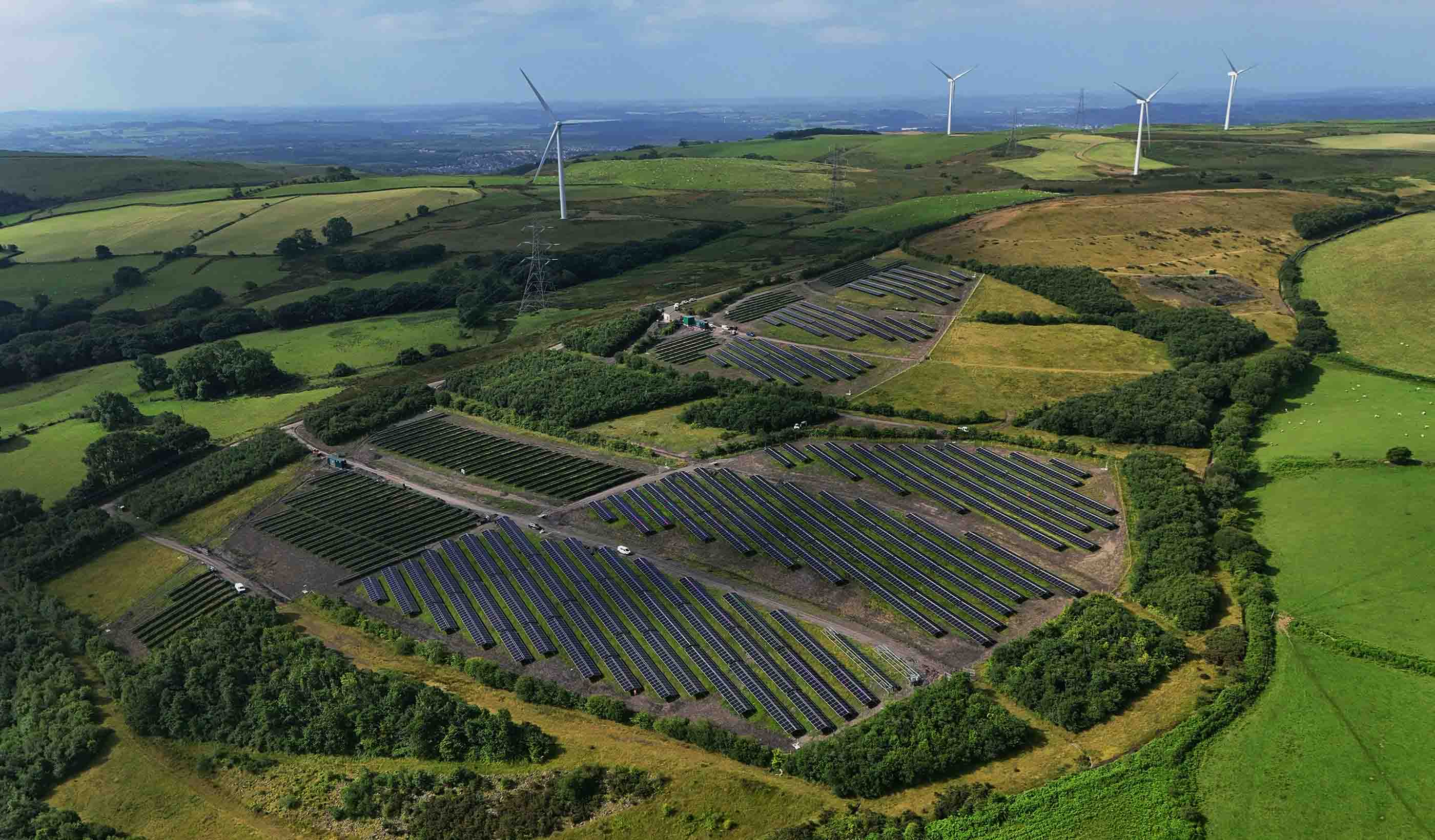
"eyebrow": "SUSTAINABILITY",
"title": "2025 Sustainability Report: Highlighting Stantec’s contributions to our communities",
"ctaText": "READ MORE",
"link": "\/en\/about\/sustainability\/2025\u002Dsustainability\u002Dreport.html",
"backgroundColor": "bg\u002Ddarker\u002Dgreen",
"mediaOption": "image",
"image": {
"imageLarge": "\/content\/dam\/stantec\/images\/stock\/other\/0021\/sustainability\u002Dreport\u002D2025\u002Dpromo\u002Dcoed\u002Dely\u002Dsolar\u002D.jpg",
"imageMedium": "\/content\/dam\/stantec\/images\/stock\/other\/0021\/sustainability\u002Dreport\u002D2025\u002Dpromo\u002Dcoed\u002Dely\u002Dsolar\u002D.jpg.transform\/medium\/image.20260415.jpeg",
"imageSmall": "\/content\/dam\/stantec\/images\/stock\/other\/0021\/sustainability\u002Dreport\u002D2025\u002Dpromo\u002Dcoed\u002Dely\u002Dsolar\u002D.jpg.transform\/small\/image.20260415.jpeg",
"imageAltText": "Aerial view of a solar farm"
}
},
{
"eyebrow": "ABOUT Stantec",
"title": "Together, we turn what if into we did",
"ctaText": "Learn More",
"link": "\/en\/about\/better\u002Dtogether.html",
"backgroundColor": "",
"mediaOption": "image",
"image": {
"imageLarge": "\/content\/dam\/stantec\/images\/stock\/Stock%20People\/0003\/better\u002Dtogether\u002Dpromo.jpg",
"imageMedium": "\/content\/dam\/stantec\/images\/stock\/Stock%20People\/0003\/better\u002Dtogether\u002Dpromo.jpg.transform\/medium\/image.20260128.jpeg",
"imageSmall": "\/content\/dam\/stantec\/images\/stock\/Stock%20People\/0003\/better\u002Dtogether\u002Dpromo.jpg.transform\/small\/image.20260128.jpeg",
"imageAltText": "A collage of people"
}
},
{
"eyebrow": "ENERGY",
"title": "Capturing and managing carbon emissions",
"ctaText": "Read More",
"link": "\/en\/markets\/energy\/what\u002Dis\u002Dcarbon\u002Dcapture\u002Dutilization\u002Dstorage\u002Dccus.html",
"backgroundColor": "bg\u002Dblack",
"mediaOption": "image",
"image": {
"imageLarge": "\/content\/dam\/stantec\/images\/stock\/other\/0020\/forest\u002Dpine\u002Dtrees\u002Dadobestock\u002D144733150.jpg",
"imageMedium": "\/content\/dam\/stantec\/images\/stock\/other\/0020\/forest\u002Dpine\u002Dtrees\u002Dadobestock\u002D144733150.jpg.transform\/medium\/image.20250218.jpeg",
"imageSmall": "\/content\/dam\/stantec\/images\/stock\/other\/0020\/forest\u002Dpine\u002Dtrees\u002Dadobestock\u002D144733150.jpg.transform\/small\/image.20250218.jpeg",
"imageAltText": "A forest of pine trees"
}
},
{
"eyebrow": "CITIES",
"title": "Reimagining resilience starts with the heart of community",
"ctaText": "Learn More",
"link": "\/en\/ideas\/content\/video\/2025\/reimagining\u002Dresilience\u002Dstarts\u002Dwith\u002Dthe\u002Dheart\u002Dof\u002Dcommunity.html",
"backgroundColor": "",
"mediaOption": "image",
"image": {
"imageLarge": "\/content\/dam\/stantec\/images\/ideas\/video\/0005\/reimagining\u002Dresilience\u002Dnatalie\u002Dvogt.jpg",
"imageMedium": "\/content\/dam\/stantec\/images\/ideas\/video\/0005\/reimagining\u002Dresilience\u002Dnatalie\u002Dvogt.jpg.transform\/medium\/image.20250815.jpeg",
"imageSmall": "\/content\/dam\/stantec\/images\/ideas\/video\/0005\/reimagining\u002Dresilience\u002Dnatalie\u002Dvogt.jpg.transform\/small\/image.20250815.jpeg",
"imageAltText": "Nadia Vogt beside an aerial view of a pedestrial walkway alongside a road."
}
},
{
"eyebrow": "ENVIRONMENT",
"title": "Relationships built to weather the storm: resilience in action",
"ctaText": "Learn More",
"link": "\/en\/ideas\/content\/video\/2026\/2\u002Dam\u002Dphone\u002Dcall\u002Dwhen\u002Ddisaster\u002Dstrikes\u002Dbetter\u002Dtogether\u002Dapproach\u002Donly\u002Dapproach.html",
"backgroundColor": "bg\u002Dstantec\u002Dorange",
"mediaOption": "image",
"image": {
"imageLarge": "\/content\/dam\/stantec\/images\/ideas\/video\/0005\/better\u002Dtogether\u002Dgrant\u002Dmaxwell.jpg",
"imageMedium": "\/content\/dam\/stantec\/images\/ideas\/video\/0005\/better\u002Dtogether\u002Dgrant\u002Dmaxwell.jpg.transform\/medium\/image.20260527.jpeg",
"imageSmall": "\/content\/dam\/stantec\/images\/ideas\/video\/0005\/better\u002Dtogether\u002Dgrant\u002Dmaxwell.jpg.transform\/small\/image.20260527.jpeg",
"imageAltText": "Group of people at a table reviewing project plans."
}
}
]}
{
"id": "super\u002Da07b9666\u002D9a6c\u002D4c79\u002Db615\u002D424b2f060aca",
"title": " ",
"theme": "white",
"tileStyle": "image",
"ctaType": "nocta",
"ctaLink": {
"url": "",
"text": ""
},
"tilesPerRow": 2,
"colWidth": "col_6",
"readMore": "Read More",
"showMore": "Show More",
"pages": [
{
"jcrTitle": "CEO Gord Johnston on Stantec—and our impact on the world",
"contentType": "Video",
"promotionalImage": "\/content\/dam\/stantec\/images\/ideas\/video\/0005\/gord\u002Djohnston\u002D2026\u002Dceo\u002Dvideo.jpg",
"pageLink": {
"url": "\/en\/ideas\/watch\/ceo\u002Dgord\u002Djohnston\u002Don\u002Dstantec\u002Dand\u002Dour\u002Dimpact\u002Don\u002Dthe\u002Dworld.html"
}
},
{
"jcrTitle": "Stantec announces winners of inaugural Stanley Awards",
"contentType": "News Release",
"promotionalImage": "\/content\/dam\/stantec\/images\/landing\u002Dpages\/news\u002Dblogs\/2026\/stanley\u002Dawards\u002D2026.jpg",
"pageLink": {
"url": "\/en\/news\/2026\/stantec\u002Dannounces\u002Dwinners\u002Dinaugural\u002Dstanley\u002Dawards.html"
}
}
]
}
{
"id": "super\u002Db6fb65dc\u002D5556\u002D4bc4\u002Daaf1\u002D830c4c9176d1",
"title": " ",
"theme": "white",
"tileStyle": "text",
"ctaType": "nocta",
"ctaLink": {
"url": "",
"text": ""
},
"tilesPerRow": 4,
"colWidth": "col_3",
"readMore": "Read More",
"showMore": "Show More",
"pages": [
{
"jcrTitle": "First phase of Lower Manhattan’s Battery Coastal Resilience Project complete",
"contentType": "News Release",
"promotionalImage": "\/content\/dam\/stantec\/images\/projects\/0040\/lower\u002Dmanhattan\u002Dbattery\u002Dcoastal\u002D4.jpg",
"pageLink": {
"url": "\/en\/news\/2026\/first\u002Dphase\u002Dlower\u002Dmanhattans\u002Dbattery\u002Dcoastal\u002Dresilience\u002Dproject\u002Dcomplete.html"
}
},
{
"jcrTitle": "Stantec contributes building systems engineering to the Obama Presidential Center in Chicago",
"contentType": "News Release",
"promotionalImage": "\/content\/dam\/stantec\/images\/landing\u002Dpages\/news\u002Dblogs\/2026\/obama\u002Dpresidential\u002Dcenter\u002D3.jpg",
"pageLink": {
"url": "\/en\/news\/2026\/stantec\u002Dcontributes\u002Dbuilidng\u002Dsystems\u002Dengineering\u002Dobama\u002Dpresidential\u002Dcenter\u002Dchicago.html"
}
},
{
"jcrTitle": "Stantec to help drive redevelopment for City of Vallejo",
"contentType": "News Release",
"promotionalImage": "\/content\/dam\/stantec\/images\/landing\u002Dpages\/news\u002Dblogs\/2026\/mare\u002Disland.jpg",
"pageLink": {
"url": "\/en\/news\/2026\/stantec\u002Dhelp\u002Ddrive\u002Dredevelopment\u002Dcity\u002Dvallejo.html"
}
},
{
"jcrTitle": "Black \x26 Veatch\u002DStantec Joint Venture to lead U.S. Army Corps of Engineers Brandon Road Interbasin ecosystem protection project ",
"contentType": "News Release",
"promotionalImage": "\/content\/dam\/stantec\/images\/landing\u002Dpages\/news\u002Dblogs\/2026\/brandon\u002Droad\u002Dinterbasin.jpg",
"pageLink": {
"url": "\/en\/news\/2026\/black\u002Dveatch\u002Dstantec\u002Djoint\u002Dventure\u002Dus\u002Darmy\u002Dcorps\u002Dengineers\u002Dbrandon\u002Droad\u002Dinterbasin\u002Decosystem\u002Dprotection.html"
}
}
]
}
{
"descriptionTitle": "With every community, we redefine what’s possible",
"descriptionText": "Stantec is a global leader in sustainable engineering, architecture, and environmental consulting. We innovate at the intersection of community, creativity, and client relationships so that together we can redefine what’s possible. ",
"pillars": [
{
"title": "Community",
"titleImageXml": "",
"titleImageAltText": "Group of people with full garbage bags",
"projectName": "Partnering with the Nature Conservancy of Canada to protect ecosystems",
"projectLocation": "Canada",
"descriptionTitle": "Environmental Stewardship",
"descriptionBody": "Protecting ecologically significant Boreal Forest",
"linkText": "Learn More",
"linkUrl": "\/en\/news\u002Dmedia\/2026\/stantec\u002Dpartners\u002Dwith\u002Dthe\u002Dnature\u002Dconservancy\u002Dof\u002Dcanada.html",
"titleImageFileReference": "\/content\/dam\/stantec\/images\/homepage\u002Dpillars\/2026\/community\u002Dpillar\u002Dmay.jpg"
},
{
"title": "Creativity",
"titleImageXml": "",
"titleImageAltText": "Transit line in Chicago",
"projectName": "Engineering solutions for a megaproject in a dense urban environment",
"projectLocation": "Chicago, Illinois",
"descriptionTitle": "Mass Transit",
"descriptionBody": "Upgrading Chicago\x27s transit system for the next century of growth",
"linkText": "Watch Now",
"linkUrl": "\/en\/ideas\/content\/video\/2026\/threading\u002Dthe\u002Dneedle\u002Dupgrading\u002Dthe\u002Dl\u002Din\u002Dthe\u002Dheart\u002Dof\u002Durban\u002Dchicago.html",
"titleImageFileReference": "\/content\/dam\/stantec\/images\/homepage\u002Dpillars\/2026\/creativity\u002Dpillar\u002Dmay.jpg"
},
{
"title": "Clients",
"titleImageXml": "",
"titleImageAltText": "Water treatment tank",
"projectName": "Partnering with clients for Water Research Foundation initiative",
"projectLocation": "United States",
"descriptionTitle": "Future Technology",
"descriptionBody": "How artificial intelligence is improving wastewater treatment performance",
"linkText": "Read Now",
"linkUrl": "\/en\/news\/2026\/stantec\u002Dpartners\u002Dwssc\u002Dwater\u002Dprince\u002Dwilliam\u002Dwater\u002Dnew\u002Dwater\u002Dresearch\u002Dfoundation\u002Dai\u002Dinitiative.html",
"titleImageFileReference": "\/content\/dam\/stantec\/images\/homepage\u002Dpillars\/2026\/client\u002Dpillar\u002Dmay\u002Dadobestock\u002D383929765.jpg"
}
]
}
{
"title": "Our People",
"multiplePeople": true,
"newTab": false,
"cta": {
"url": "",
"text": ""
},
"people": [
{
"identifier": "fraser\u002Dmichelle",
"firstName": "Michelle",
"lastName": "Fraser",
"jobTitle": "Principal, Technical Discipline Leader, Water Resources (Canada)",
"quote": "Work together—no one is successful on their own, there’s always a network of people and experiences behind them.",
"cta": {
"url": "\/en\/people\/f\/fraser\u002Dmichelle.html",
"text": "Read More"
},
"largeImagePath": "\/content\/dam\/stantec\/images\/people\/f\/michelle\u002Dfraser\u002Dheadshot.jpg.transform\/small\/image.20190515.jpeg",
"mediumImagePath": "\/content\/dam\/stantec\/images\/people\/f\/michelle\u002Dfraser\u002Dheadshot.jpg.transform\/320w\/image.20190515.jpeg",
"smallImagePath": "\/content\/dam\/stantec\/images\/people\/f\/michelle\u002Dfraser\u002Dheadshot.jpg.transform\/153w\/image.20190515.jpeg"
},
{
"identifier": "mullins\u002Dbrendan",
"firstName": "Brendan",
"lastName": "Mullins",
"jobTitle": "Principal, Discipline Leader, Design Computing",
"quote": "The key to my success has been to remain passionate that my ideas will better the company.",
"cta": {
"url": "\/en\/people\/m\/mullins\u002Dbrendan.html",
"text": "Read More"
},
"largeImagePath": "\/content\/dam\/stantec\/images\/people\/m\/brendan\u002Dmullins.jpg.transform\/small\/image.20240619.jpeg",
"mediumImagePath": "\/content\/dam\/stantec\/images\/people\/m\/brendan\u002Dmullins.jpg.transform\/320w\/image.20240619.jpeg",
"smallImagePath": "\/content\/dam\/stantec\/images\/people\/m\/brendan\u002Dmullins.jpg.transform\/153w\/image.20240619.jpeg"
},
{
"identifier": "bernedo\u002Dcarmen",
"firstName": "Carmen",
"lastName": "Bernedo Sanchez",
"jobTitle": "Senior Principal, Energy",
"quote": "Embracing the challenges of finding solutions for clients amidst diverse environments and complex technical requirements is something I really enjoy.",
"cta": {
"url": "\/en\/people\/b\/bernedo\u002Dcarmen.html",
"text": "Read More"
},
"largeImagePath": "\/content\/dam\/stantec\/images\/people\/b\/carmen\u002Dbernedo.jpg.transform\/small\/image.20220112.jpeg",
"mediumImagePath": "\/content\/dam\/stantec\/images\/people\/b\/carmen\u002Dbernedo.jpg.transform\/320w\/image.20220112.jpeg",
"smallImagePath": "\/content\/dam\/stantec\/images\/people\/b\/carmen\u002Dbernedo.jpg.transform\/153w\/image.20220112.jpeg"
},
{
"identifier": "ducey\u002Djennifer",
"firstName": "Jennifer",
"lastName": "Ducey",
"jobTitle": "Vice President, Regional Business Leader, Transportation (US Northeast)",
"quote": "No two projects are exactly the same, and I’m always learning something new.",
"cta": {
"url": "\/en\/people\/d\/ducey\u002Djennifer.html",
"text": "Read More"
},
"largeImagePath": "\/content\/dam\/stantec\/images\/people\/d\/jennifer\u002Dducey\u002Dbw.jpg.transform\/small\/image.20231106.jpeg",
"mediumImagePath": "\/content\/dam\/stantec\/images\/people\/d\/jennifer\u002Dducey\u002Dbw.jpg.transform\/320w\/image.20231106.jpeg",
"smallImagePath": "\/content\/dam\/stantec\/images\/people\/d\/jennifer\u002Dducey\u002Dbw.jpg.transform\/153w\/image.20231106.jpeg"
},
{
"identifier": "peyton\u002Dscott",
"firstName": "Scott",
"lastName": "Peyton",
"jobTitle": "Vice President, Water Resources Sector Leader",
"quote": "It’s important to improve accessibility and connections with our streams, rivers and greenways through restoration and enhancement.",
"cta": {
"url": "\/en\/people\/p\/peyton\u002Dscott.html",
"text": "Read More"
},
"largeImagePath": "\/content\/dam\/stantec\/images\/people\/p\/scott\u002Dpeyton\u002Dheadshot.jpg.transform\/small\/image.20190515.jpeg",
"mediumImagePath": "\/content\/dam\/stantec\/images\/people\/p\/scott\u002Dpeyton\u002Dheadshot.jpg.transform\/320w\/image.20190515.jpeg",
"smallImagePath": "\/content\/dam\/stantec\/images\/people\/p\/scott\u002Dpeyton\u002Dheadshot.jpg.transform\/153w\/image.20190515.jpeg"
},
{
"identifier": "adams\u002Damanda",
"firstName": "Amanda",
"lastName": "Adams",
"jobTitle": "Principal, Operations Leader, Mining, Minerals \x26 Metals",
"quote": "My passions are leading diverse teams to solve complex problems for mine waste storage and sharing my love of my job with future engineers!",
"cta": {
"url": "\/en\/people\/a\/adams\u002Damanda.html",
"text": "Read More"
},
"largeImagePath": "\/content\/dam\/stantec\/images\/people\/a\/amanda\u002Dadams\u002Dheadshot.jpg.transform\/small\/image.20190515.jpeg",
"mediumImagePath": "\/content\/dam\/stantec\/images\/people\/a\/amanda\u002Dadams\u002Dheadshot.jpg.transform\/320w\/image.20190515.jpeg",
"smallImagePath": "\/content\/dam\/stantec\/images\/people\/a\/amanda\u002Dadams\u002Dheadshot.jpg.transform\/153w\/image.20190515.jpeg"
}
]
}
{
"uuid": "work\u002Dwith\u002Dus\u002Dmodule\u002Dwork_with_us_0",
"imageLarge": "\/content\/dam\/stantec\/images\/landing\u002Dpages\/homepage\/010_2113_V5.jpg",
"imageMedium": "\/content\/dam\/stantec\/images\/landing\u002Dpages\/homepage\/010_2113_V5.jpg.transform\/medium\/image.20240705.jpeg",
"imageSmall": "\/content\/dam\/stantec\/images\/landing\u002Dpages\/homepage\/010_2113_V5.jpg.transform\/small\/image.20240705.jpeg",
"headline": "We’re better together",
"items": [
{
"headline": "Become a client",
"description": "Partner with us today to change how tomorrow looks. You’re exactly what’s needed to help us make it happen in your community.",
"ctaText": "Contact Us",
"ctaUrl": "\/en\/about\/contact\u002Dus.html"
},
{
"headline": "Design your career",
"description": "Work with passionate people who are experts in their field. Our teams love what they do and are driven by how their work makes an impact on the communities they serve.",
"ctaText": "Join the Team",
"ctaUrl": "\/en\/careers.html"
}
]
}