Digital
People to the power of technology
We harness the expertise of professional scientists, engineers, and architects to create powerful digital solutions that enhance how we address critical challenges. By blending domain knowledge with cutting-edge technologies—such as digital twins, artificial intelligence, machine learning, and advanced automation—we enable faster, more efficient, and scalable solutions that drive real-world impact.
We’re working to integrate these emerging technologies safely and responsibly to help you become proactive problem solvers, no matter what challenge you’re facing.
Our focus is on finding the right solution for your needs. Sometimes that means integrating an existing digital solution; it can also mean offering tailored consulting or solutions. Either way, we deliver high-quality, practical outcomes that address the problems facing you and your communities.
Whether automating processes, providing specialized consulting insights, or advancing innovative design, we focus on empowering our people and clients with future-ready solutions to work smarter and deliver more. Faster.


Harnessing AI to redefine possibilities
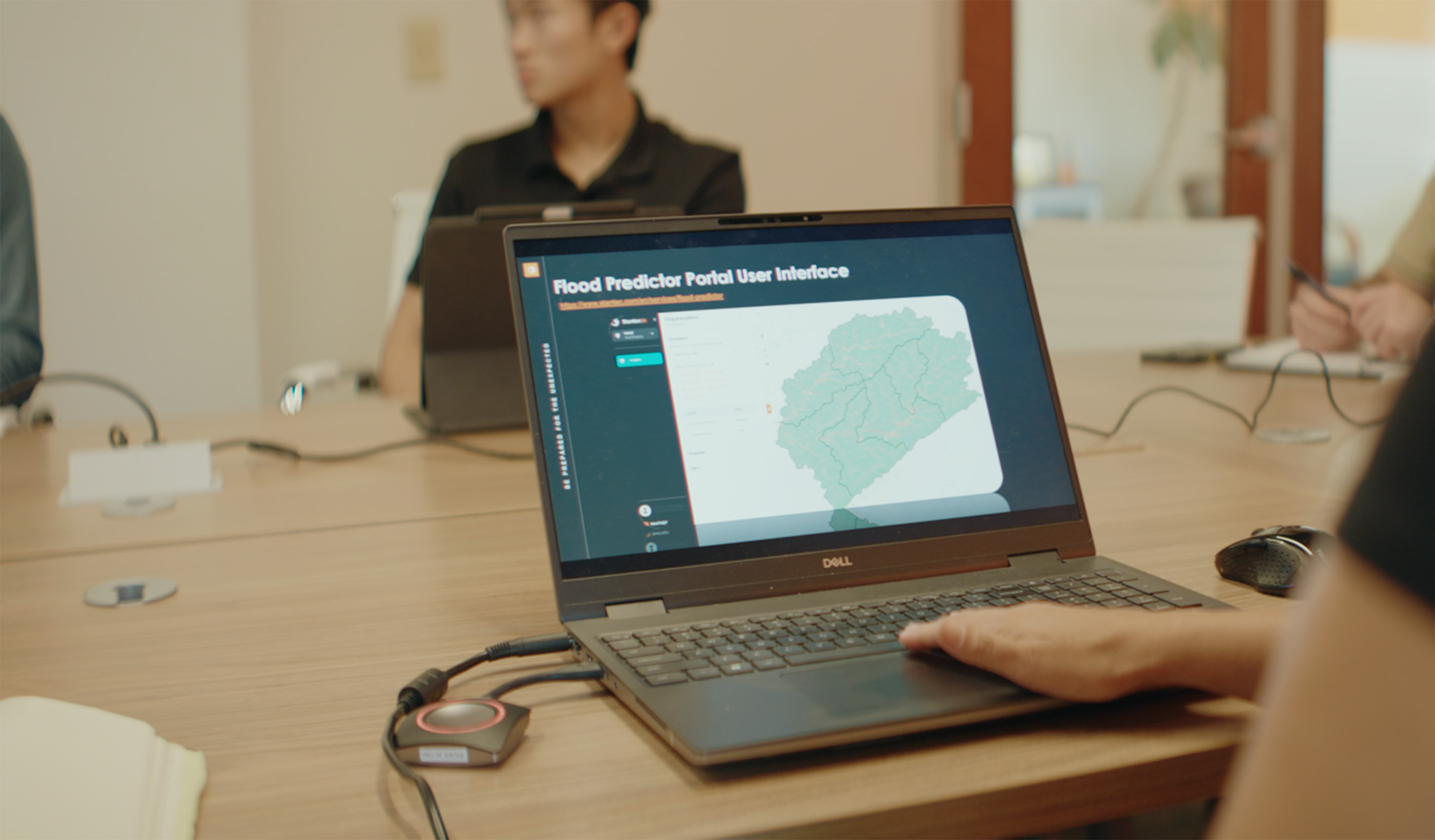
Artificial intelligence (AI) is central to how we help you solve complex challenges. By integrating AI and machine learning into our digital strategy and offerings, we unlock new levels of insight, efficiency, and innovation. From accelerating data analysis and enhancing design processes to improving project delivery and enabling faster, smarter decision-making, AI helps us amplify our science, engineering, and design expertise to deliver meaningful, transformative outcomes for our clients and communities. Learn More


Digital solutions to address your biggest challenges
Our digital solutions are crafted by our industry specialists, blending cutting-edge technology with years of hands-on experience in solving client challenges. Each solution is designed to address real-world needs and drive smarter, more efficient outcomes. Explore how our digital tools can empower your projects and pave the way for a future-ready approach to innovation. Read MoreOur People
-

Dave Roberts
Chief Digital Officer
-

Brandy Little
Principal, Director, Assets & Products
-

Kim Hubbert
Innovation Leader, Energy & Resources
-

Matt Wagoner
Senior Principal, Business Center Practice Leader
-

Pete Perciavalle
Senior Vice President, Water Innovation Leader
-

Brett Stewart
Head of Digital Solutions, UK
-

Steven Costa
Design/Delivery Technology Leader
-

Louisa Bloomer
Director Digital Technology, Asia Pacific
-

Sail Wu
Director
-

Andrew Preston
Principal, Director Software Development
-

Marc Pearson
Senior Principal, Environmental Services


We’re better together
-
Become a client
Partner with us today to change how tomorrow looks. You’re exactly what’s needed to help us make it happen in your community.
-
Design your career
Work with passionate people who are experts in their field. Our teams love what they do and are driven by how their work makes an impact on the communities they serve.