A new digital tool can help predict landslides, protecting people and infrastructure
March 23, 2021
March 23, 2021
DebrisFlow Predictor is a new solution to an old—and dangerous—problem in mountainous regions
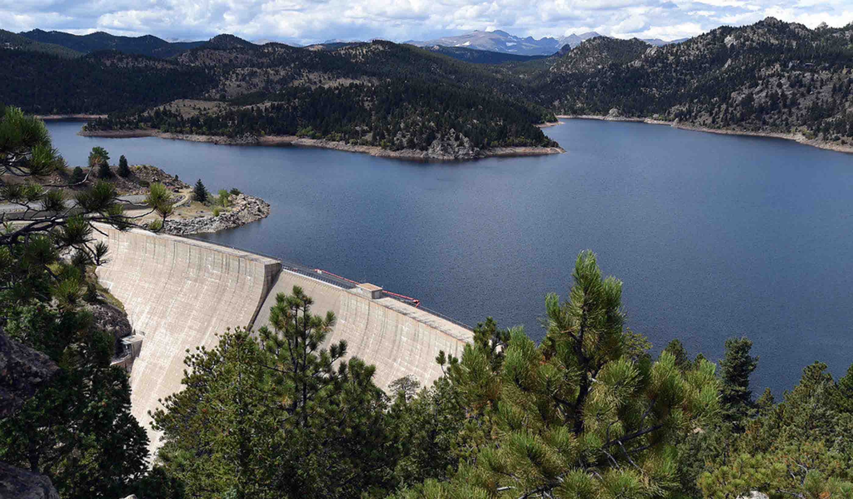
Mountains cover about 30% of our global land surface. These rugged landscapes supply much of the world’s water, provide critical economic resources, and support the lives of hundreds of millions of people.
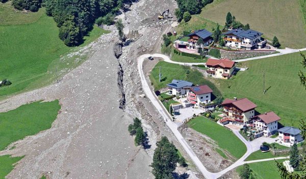
But mountains are also the source of some of the world’s deadliest hazards. Landslides threaten lives, infrastructure, and environments in mountain regions worldwide. Debris flows and debris avalanches are a common type of landslide that occur in the mountains. The high velocity and long travel distance of debris flows and debris avalanches make them particularly destructive. While experts can already identify the areas where debris flow may develop, few models can predict downstream impacts, runout paths, and the extent of possible destruction caused by these landslides.
Enter DebrisFlow Predictor, a software program developed by our expert team at Stantec. It can reasonably predict the path—and potential impacts—of extremely rapid flow-type landslides. The software can help protect people, the environment, and infrastructure.
Mountains cover almost one third of our global land surface—and they are the source of some of the world’s deadliest hazards.
Before we look at how DebrisFlow Predictor works, let’s explore some essential background.
What exactly is a landslide? It is the downslope movement of rock, soil, and debris, under the influence of gravity. And, while there are many types of landslides, one of the more destructive is called a debris flow. Debris flows travel quickly—tens of kilometres per hour (km/h) to, in rare cases, hundreds of km/h—and they can travel a long distance from their source. They belong to a family of flow-type landslides that, like the name implies, flow downslope, losing their internal structure, and are guided by the local topography. Debris flows frequently start in the high mountains and emerge suddenly with substantial destructive force onto a fan lower in the landscape. Debris avalanches are similar but more prone to open slopes.
Debris flows frequently start in the high mountains and emerge suddenly with substantial destructive force onto a fan lower in the landscape.
While there are many reasons that debris flows and avalanches occur, they are frequently triggered by events like rainstorms and earthquakes. If the ground has been preprepared—such as during the western US wildfires, which removed vegetation and created hydrophobic soils—the danger increases considerably.
Our team developed DebrisFlow Predictor to forecast the outcomes of debris flows or avalanches. Designed to work with expert judgment, the software predicts a landslide’s path, the depth along the path, the total area, and volume. Better yet, it is efficient to deploy, works with limited data inputs, and is applicable to large surface areas.
To date, there is no other program like it. It’s a new solution to an old—and dangerous—problem.
DebrisFlow Predictor can reasonably predict the path—and potential impacts—of extremely rapid flow-type landslides.
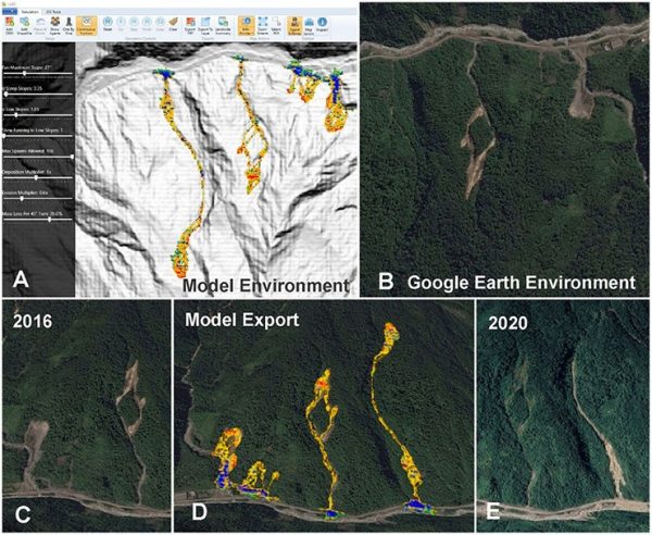
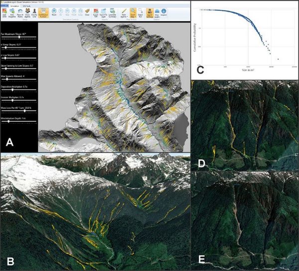
But how does it work? The program operates on the principles of cellular automata, which is a set of cells or agents that act on a grid that evolves over a series of discrete time steps according to a set of rules and the state of neighboring cells. In this manner, relatively simple rules that underly the program produce complex dynamic behavior. The software estimates the sediment volume along a landslide path by deploying 5-metre-sized agents over a digital-elevation model (DEM) of the same resolution.
Think of each agent as a program within a program. In DebrisFlow Predictor, these agents are autonomous subroutines that apply the set of rules over the DEM we are analyzing. Applying more than 15 years of debris-flow studies by multiple experts, we developed a series of probabilistic rules for scour, deposition, path selection, and fanning and merging behavior, that each agent follows. In this way, agents interact with the surface of our model, and with each other, to resolve a possible outcome. And while each solution is unique, we can run the program multiple times to better understand the range of possible outcomes and solutions.
DebrisFlow Predictor is a fully self-contained program. However, it plays nicely with other programs that allow the landslide professional to conduct additional analyses. It exports data as GeoTIFFS, Shapefiles, and Excel files, retaining detailed information to each file type. Using some of these features, we can apply damage curves to estimate the destructive potential of a debris flow to infrastructure, including buildings, to compare magnitude frequency characteristics against those known for a region, or overlay the results onto air photographs and satellite imagery for unmatched communication.
Designed to complement expert judgment, DebrisFlow Predictor can forecast a landslide’s path, the depth along the path, the total area, and volume of the debris flow.
We can’t stop all the hazards presented by mountainous terrain. But with DebrisFlow Predictor, we are in a better position to help protect communities, families, and infrastructure from devastating landslide hazards.