Soil carbon models: How remote sensing can measure the carbon stored in your soil
October 04, 2023
October 04, 2023
Looking to quantify the carbon on your land? It’s possible to build accurate soil carbon models using remote sensing and machine learning.
Do you know how much carbon is stored in your soil? Quantifying that amount can help you achieve your environment, social, and governance (ESG) goals, as scientists estimate that soils store almost double the amount of carbon stored in the atmosphere, plants, and animals combined.
The large carbon storage capacity of soils is important in the global voluntary carbon market. Practices that protect existing soil carbon or rebuild depleted soil carbon stocks can offset less sustainable practices. It can help you meet your net zero goals.
But quantifying soil carbon at any given site can be challenging. Why? Because, depending on the system, several factors impact soil carbon storage.
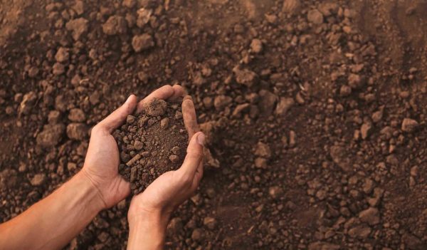
Soils represent a carbon sink with their ability to store massive amounts of carbon.
This is where our CarbonWATCH service comes in. CarbonWATCH monitors carbon sequestration both above (vegetation) and below (soil) ground across large sites and in remote areas. This technique, which calculates carbon across space and time from remote sensing imagery, can save you time and money. With the soil carbon module of CarbonWATCH, you can say goodbye to manually sampling for soil carbon in the field.
Martha started developing the soil carbon module several years ago in grad school. She was brainstorming unique ways to use remote sensing techniques.
The ability to correctly quantify soil carbon could intrigue organizations in many industries. These include mining, energy, oil and gas, and others. Soil can be a critical tool in combatting climate change or achieving carbon-emission reduction goals. Let’s explain more.
First, some context. There is growing evidence that Earth’s climate is changing in response to the increase of greenhouse gases in the atmosphere. Carbon dioxide (CO2) has the biggest impact on the global climate. Concentrations have increased since the Industrial Revolution—largely due to human activities. Carbon sequestration, the process of capturing and storing CO2 from the atmosphere, offers promise as an approach to reduce the impact of global climate change.
Soils can store massive amounts of carbon. This process is primarily controlled through photosynthesis; it’s when carbon enters the ground as soil organic carbon. Despite the potential, it’s difficult to quantify soil carbon. This means that there’s a large unknown in carbon storage estimates over time and under various land management practices.

Remote sensing can be used to observe patterns that are known to impact soil carbon storage.
Quantifying soil carbon can be quite difficult across both small and large scales. There can be a lot of variation in soil properties due to several factors. Cold wet systems, where rates of photosynthesis are higher than rates of decomposition, have high soil organic carbon concentrations. In contrast, hot arid systems have less plant productivity and lower levels of soil carbon storage.
Other factors beyond climate and plant growth also impact soil carbon dynamics. Topography, for example, can impact how resources move across a landscape when rain occurs. Depressions where water and litter gather would have more resources to support decomposition, which would impact soil carbon storage. Accurate modeling of soil carbon storage allows us to quantify the impact of land conditions and observe how treatments affect soil carbon storage over time.
But established approaches to quantifying soil carbon across sites—such as through the collection of point-based samples—can involve lots of time and dollars. For example, visiting a location, collecting soil samples across the site, then analyzing hundreds of samples in a lab can take weeks to months. Plus, it’s tough to extrapolate those point-based measurements across an entire area of space.
Thankfully, there’s an easier way to quantify how much carbon is in your soil.
Let’s discuss our approach to modeling soil carbon, which is part of our CarbonWATCH suite.
Remote sensing is the acquisition of data using sensors or cameras on drones or satellites. We can use remote sensing to observe patterns that are known to impact soil carbon storage. These patterns include vegetation dynamics, soil characteristics, weather patterns, and topography. We use satellite imagery to model and observe these patterns.
Then, we can extend these aboveground patterns to model soil carbon storage across large areas with machine learning. We build models based on ground measurements of soil carbon and remote sensing variables at those locations. After a model is trained on data from the sample locations, we can then apply it back on the remote sensing imagery to get soil carbon predictions for the entire study area.
Scientists estimate that soils store almost double the amount of carbon stored in the atmosphere, plants, and animals combined.
We are not seeing soil carbon directly. But we’re analyzing the different factors that may have an influence on it and using those factors to predict soil carbon distribution across an area of interest.
This approach lets us identify areas that have a high or low potential for soil carbon storage in future projects. We can also quantify the impact of various land conditions on soil carbon and see how different treatments affect soil carbon storage. Together, these advances provide thorough modeling and tracking of soil carbon storage over time.
This data will help you see the impact that your practices have on belowground carbon storage. Once you’ve identified areas that are high or low, you can plan management practices to try to conserve or enhance soil carbon storage.
For example, if you’re a mine owner and you’re planting trees to rehab abandoned mines, we can track the changes in soil carbon over time with plant growth. Then, you can check a year later to see the difference that the tree planting made.
We recently used this module for a project in Northern Nevada, where we found soil carbon values to range from 1.3 kilograms/m2 to 4.12kg/m2 across the study site. There were 29 remote sensing data inputs. But we only needed 6 to successfully model soil carbon. These variables included bare soil coverage, normalized difference vegetation index (which informs plant health/productivity), an estimate of soil bulk density, elevation, and an index based on topography that informs where water will accumulate across the landscape.
This approach reduces the need for extensive on-the-ground sampling and provides large-scale predictions of soil carbon in a time- and cost-effective manner. Then, once models are developed, we can adopt them across space and time. That provides us future predictions of soil carbon for multiple locations of interest.
This project isn’t limited to predictions of soil carbon. We can extend it to predictions of soil health and functionality. Down the road, we believe that the agriculture sector could use this type of product. Identifying areas of high/low soil health could help direct planting efforts and help farmers get maximum crop yields and productivity.

This approach to modeling soil carbon could be used in the agriculture sector to predict soil health and functionality.
When it comes to the future and remote sensing in general, we’re at the forefront of a big data revolution. We’re getting more—and better quality—data than we ever have. For example, in 2023, we will see the launch of the world’s highest resolution hyperspectral satellite constellation. It can provide daily images with unmatched spectral detail and cadence. This data allows us to get a better and deeper understanding of our environment.
How does more and better data impact this technique? Having more detailed vegetation observations—or any of the other input remote-sensing datasets—improves the final soil carbon prediction.
In the end, using the technology for this approach will solve a big unknown in our understanding of ecological systems. And we’re proud to work on it.

